Who Are the Top Industrial Drone Manufacturers in China?
China’s industrial drone market serves agriculture, surveying, infrastructure inspection, energy, and emergency-response teams. Manufacturers compete on more than flight time. Payload capacity, sensor options, flight stability, maintenance support, and software compatibility can matter just as much. On a construction site, for example, a clear aerial image is useful only if the aircraft can repeat the route and deliver data that teams can review. Small details matter.
This guide examines companies often considered among China’s leading industrial drone manufacturers. It looks at product focus, application experience, technical capabilities, and the practical support available to customers. Rather than treating a single specification as proof of quality, the comparison considers how equipment performs across real work conditions. A long advertised flight time may not reflect performance with a heavy camera or in strong wind. No comparison is perfect.
Readers can use these points to narrow their choices, then check current specifications and service terms directly with each manufacturer. Public product information may not answer every question, and company claims can be difficult to compare on equal terms. That limitation deserves attention. The best Industrial Drone is not automatically the newest or most powerful model; it is the one that reliably fits a team’s operating needs, training level, and budget.
Define Industrial Drones by Platform Type, Payload, and Mission
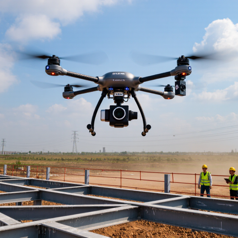
When comparing industrial drone manufacturers in China, define the aircraft by its platform, payload, and mission—not by a headline range figure. Multirotors can hover over a bridge joint or rooftop, making them useful for close inspections and short, precise surveys. Their endurance usually falls as payload weight increases. Fixed-wing platforms cover larger areas efficiently, but need suitable space and procedures for launch and recovery. Hybrid vertical-takeoff designs combine hovering with forward flight, though added mechanical complexity can affect maintenance. The trade-offs matter.
Payload means more than lifting capacity. It includes the sensor, mount, cabling, and computing equipment carried in flight. A thermal camera can help locate heat anomalies; a calibrated RGB camera supports visual documentation; LiDAR can capture dense three-dimensional detail. Each sensor brings different data needs. A neat specification sheet can mislead.
Mission defines whether the system is fit for work. A utility inspection may prioritize stable hovering and clear close-range imagery, while a mapping task may need consistent image overlap and reliable positioning. Ask how payload integration, calibration, environmental protection, training, and data delivery are handled. These details are less dramatic than flight time. They often decide whether the aircraft produces usable results. Even careful planning has limits. Conditions change.
Who Are the Top Industrial Drone Manufacturers in China? — Define Industrial Drones by Platform Type, Payload, and Mission
Industrial drones are best compared by platform, payload, and mission—not by a single manufacturer ranking. This chart shows indicative payload-capacity ranges for common platform-and-mission combinations. Actual capacity varies by aircraft design, battery, flight conditions, and payload configuration; these ranges are not manufacturer-specific specifications.
Measure China’s Drone Sector Against CAAC’s 1.27 Million Registered Aircraft in 2023
China’s drone sector is best measured by its operating scale, not by manufacturer claims. The CAAC’s 2023 Statistical Bulletin of Civil Aviation Industry Development reported 1.267 million registered civil unmanned aircraft, up 32.2% from 2022. That is a substantial fleet. It also signals demand for batteries, sensors, maintenance, and trained operators across agriculture, surveying, and infrastructure inspection.
Yet registration totals do not reveal which manufacturers lead. They include different aircraft classes and uses, and one registration is not the same as one active commercial operation. The CAAC bulletin also recorded 23.11 million hours of civil unmanned aircraft flight in 2023, offering a useful measure of use alongside fleet size. Still, hours alone say little about uptime or mission quality. A mapping team, for example, may value stable imaging and repeatable flight paths more than maximum range. That distinction matters. Procurement comparisons should therefore examine payload, endurance, service support, and operating records, not just headline production figures. The data is powerful, but incomplete.
Who Are the Top Industrial Drone Manufacturers in China? — Measure China’s Drone Sector Against CAAC’s 1.27 Million Registered Aircraft in 2023 | Sector Dimension | 2023 Data or Status | What It Indicates |
| Registered civil unmanned aircraft | Approximately 1.27 million aircraft | CAAC’s reported national registration figure provides a broad measure of the civil drone fleet. It is not a count of manufacturers or units produced during the year. |
| What the benchmark measures | Registered aircraft in the civil aviation system | The figure describes registered aircraft, not necessarily aircraft actively operating, industrial drones alone, or aircraft made in China. |
| Industrial application areas | Aerial surveying and mapping; infrastructure inspection; agriculture; logistics; emergency response | These use cases help distinguish enterprise-focused aircraft and services from recreational or consumer-oriented products. |
| Common aircraft configurations | Multirotor, fixed-wing, and hybrid vertical-take-off-and-landing designs | Configuration affects operating range, take-off requirements, hover capability, and the types of missions an aircraft can support. |
| Useful manufacturer comparison criteria | Payload compatibility, flight endurance, operating range, environmental tolerance, data security, and after-sales support | These are practical evaluation dimensions for industrial buyers; the CAAC fleet total does not rank manufacturers on these measures. |
| How to interpret the market scale | The registration total is an industry-wide reference point, not a market-share table | A defensible manufacturer ranking requires comparable company-level evidence, such as verified sales, production, or market-share data. |
| Source note: CAAC-reported 2023 registered civil unmanned-aircraft total, rounded to approximately 1.27 million as stated in the headline. Application areas and comparison criteria are sector-level descriptions, not company-specific rankings. |
Profile DJI, JOUAV, XAG, AEE, and MMC by Industrial Specialization
China’s industrial drone makers serve distinct jobs, not one uniform market. One group leads in compact multirotors for site photography, roof checks, and rapid mapping. Another builds long-endurance fixed-wing or VTOL aircraft for corridors, coastlines, and remote terrain. Flight time matters. So does launch space: a road crew may have nowhere to lay out a runway.
Agricultural specialists focus on spraying and field monitoring, with tanks, pumps, and repeatable route planning. MarketsandMarkets estimated the global agricultural drone market at US$1.7 billion in 2023, projecting US$6.1 billion by 2028. That forecast signals demand, not guaranteed returns for every operator. Rugged multirotors also target emergency response and infrastructure inspection, where stable video and quick deployment can outweigh maximum range. Heavy-lift platforms carry larger sensors or industrial payloads, but added weight can reduce endurance. A specification sheet rarely tells the whole story.
PwC’s 2016 report, Clarity from Above, estimated US$45.2 billion in potential annual economic value from drone-powered solutions for global infrastructure. This is an opportunity estimate, not measured drone sales. Buyers should compare flight logs, payload performance, maintenance access, and local service capacity. Ask for demonstrations in realistic wind and light. Even then, results may differ across sites; that limitation deserves more attention than polished claims.
Compare Manufacturer Specifications: Payload, Flight Time, Range, and IP Rating
When comparing leading industrial drone manufacturers in China, start with payload, not headline flight time. A platform rated for a heavier load may suit thermal cameras, mapping sensors, or delivery equipment. But payload reduces endurance. Ask whether published flight times use an empty aircraft, a standard battery, or a real working load. Those details are easy to miss.
Range figures need similar care. A stated maximum is not necessarily a reliable working distance; wind, terrain, signal conditions, and return reserves all affect usable range. That matters. Check whether the specification describes one-way distance or a complete mission profile.
For IP ratings, confirm the exact tested configuration, including battery covers and payload connectors. A higher rating can help in dust or rain, but it does not mean the aircraft can fly in every storm.
Manufacturer data is a useful starting point, not a substitute for a controlled demonstration. Compare figures under matching conditions, then ask for a sample flight log. Even then, results may not perfectly match your site.
Map Leading Drone Applications to Inspection, Agriculture, Surveying, and Public Safety
China’s industrial drone manufacturers serve distinct field needs, so applications offer a practical way to compare their capabilities. Inspection crews use thermal and zoom cameras to examine power lines, pipelines, roofs, and solar farms. A warm connector or loose panel may stand out from above. But glare, wind, and reflective metal can distort readings. Ground checks still matter.
In agriculture, multispectral imaging helps map crop variation and identify areas needing closer attention. Surveying teams use overlapping aerial images to build maps of roads, construction sites, and changing terrain. Accurate results depend on careful flight planning, reliable positioning, and consistent image processing. A sharp image alone is not a trustworthy measurement.
Public safety teams can use drones to view flood zones, fire perimeters, or difficult-to-reach incident areas, where an aerial perspective may help crews plan. Details matter. Privacy safeguards and trained operators should be part of the deployment, not afterthoughts. One awkward reality is that hardware gets attention, while data handling is often less polished. Buyers should test the full workflow in local conditions, not just judge a drone by its flight time.